
Tectonic learning
By Martin Horejsi
Posted on 2011-02-07
Once again, a late evening was spent on earth science worksheets. This time, however, it was not memorizing terms that presented the challenge, but rather something that caused great consternation in science in general leading up to a discovery that happened in my lifetime. (reference: http://scign.jpl.nasa.gov/learn/plate2.htm )
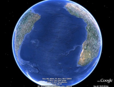
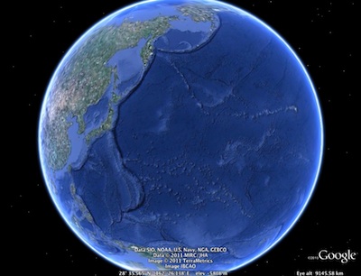
My daughter was trying to stuff the mechanics of the mid-Atlantic ridge and subduction zones into her sixth-grade head. Piece of cake, I thought. I was wrong. Briefly.
A few probing questions yielded that not much was making conceptual sense. I tried to use the images in the textbook, but didn’t pump that dry well for very long. Instead I used my favorite tool for such things…Google Earth. I do have some physical globes around the house (you know, the real spherical ones), but I needed the sea floor, and video links, and metadata, and 3-D ocean feature views, and ocean labels, and photo databases, and…and…and. …in order to learn with the fearlessness my daughter needed to explore the topic in her way.
Mere minutes later she could explain the process of plate tectonics reasonably well, show features on the earth that demonstrate the process, predict outcomes, make inferences, and best of all, show real excitement for the topic.
Then I remembered that I had an actual sample of the mid-Atlantic ridge. I won a piece of sea floor basalt at a conference a few years ago. It was brought up from the floor of the Atlantic right after it solidified. And what brought it up? Why Alvin of course. I said she could take the specimen to school and could remember the name of the submersible by thinking of Alvin and the Chipmunks. But low and behold, a few pages into the next chapter in her textbook, there was a picture of Alvin (the sub, not the rodent). The circles were closing beautifully.
After a few short BBC videos on the subject, I think we went from a skeptical 1950s view of continental movement to a 21st century view complete with powerful evidence and explanations.
While were on the topic, if Google Earth is on your list of teaching tools, may I suggest the SpaceNavigator. It makes the moving around as effortless as flying a stick-and-rudder plane. And a SpaceNavigator in the hands of students generates more questions per second than any other computer peripheral I can think of. In fact, it makes plate tectonics seem like just a simplistic explanation for a wildly complex set of inescapable processes.
For more information on GeoEverything, see our Science 2.0 column in the September 2010 issue of The Science Teacher.
Disclaimer: The views expressed in this blog post are those of the author(s) and do not necessarily reflect the official position of the National Science Teaching Association (NSTA).