
feature
Connecting With Community
Engineering sea-barriers creates civically engaged second-graders
Field trips have long been a part of the elementary student experience, and through the years a great deal of research and work has been done around how field trips best support and facilitate learning. The National Academies Press report, “Surrounded by Science: Learning Science in Informal Environments” identifies four criteria that must be tended to for field trips to effectively link students’ learning in the formal and informal settings: (1) advance preparation, (2) active participation by students in the program, (3) teacher involvement, and (4) reinforcement after the field trip (NRC 2010).
With a new earth science unit (See NSTA Connection for links to this unit in its entirety) being rolled out across our district’s second grades, the opportunity to shake up the students’ field trip experience and better meet these criteria was greeted with open minds from the district’s teachers. Though climate change and sea-level rise are not phenomena expected to be explored in second-grade, appetite for exploring these ideas and the need to “act locally” was present throughout the community and school leadership. A field trip that could intertwine both our second-grade science learning goals and an early dose of authentic civic activism toward these growing realities was therefore welcomed, provided it could be done safely, cost-effectively, and within the school day.
Planning the Field Trip Experience
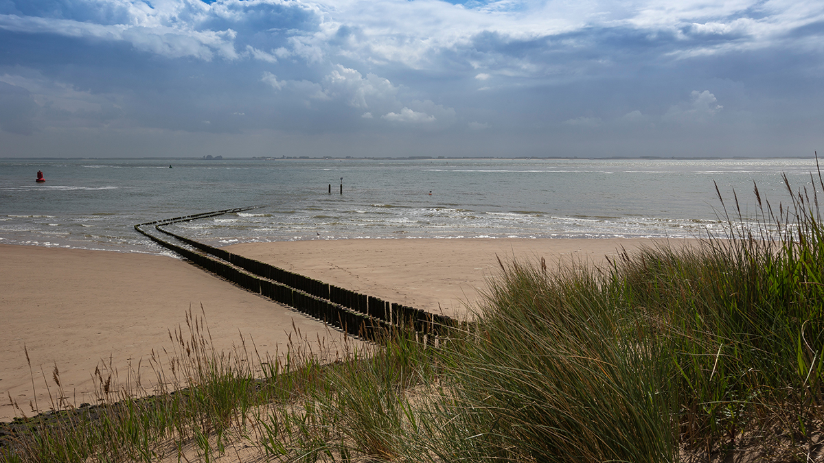
Planning started a full year prior through much dialogue with the Program Director of Mass Audubon’s Joppa Flats Education Center around tying student experiences on the trip more directly to the engineering performance expectation Compare multiple solutions designed to slow or prevent wind or water from changing the shape of the land (2-ESS2-1). As noted in Appendix A of Conceptual Shifts in the Next Generation Science Standards, “a significant difference in the Next Generation Science Standards (NGSS) is the integration of engineering and technology into the structure of science education by raising engineering design to the same level as scientific inquiry in classroom instruction” (NGSS 2013). Teachers wanted to connect classroom experiences investigating wind and water’s effect on landforms and how well sea-barriers prevent or slow erosion of coastline to a civic-engaging, sea-barrier experience supporting coastal communities facing the problem first hand.
Roadblocks arose, and workarounds were required. With much of the coastline federally protected and off-limits to public management, where would the students be able to plant? How would students with a diverse range of physical capabilities be able to participate in a way that wouldn’t harm existing fragile ecosystems? What would other experiences on the coastline and education center look like for students as they waited their turn, particularly if the weather was inclement? These challenges were taken on by the education center with input from the school’s science specialist, local residents, and their cadre of volunteers. Meanwhile, communication to the teachers and students’ families regarding expected early April weather conditions and recommended clothing to keep students comfortable along the shoreline were prepared with the expectation that the plans would ultimately come to fruition.
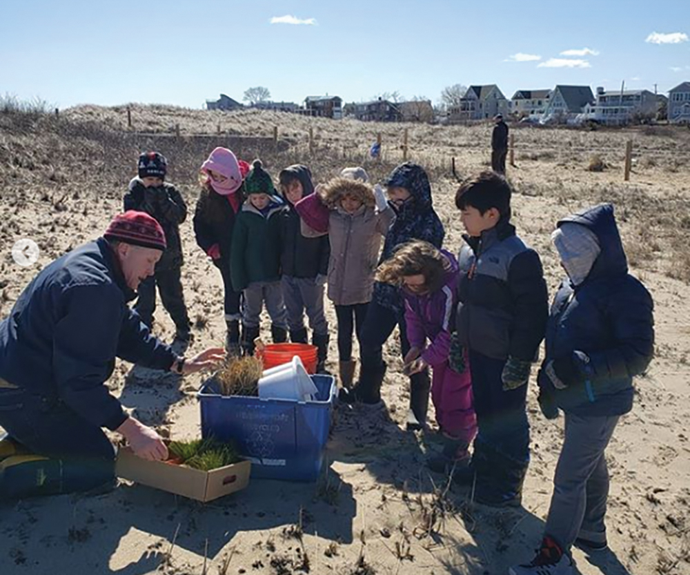
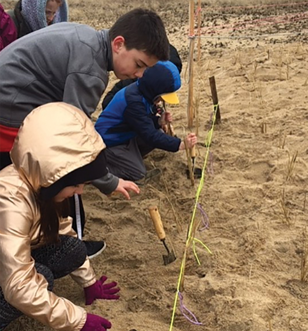
A volunteer instructs students on effective planting.
By the beginning of April the stage was set. Bundles of seagrass had been purchased and a site on public land in need of dune grass restoration had been identified by a local community member. The first busloads of students—bundled up for a winter nor’easter—arrived to leave their mark on the coastline properly. To manage the number of students on the shore and planting dunegrass at any one time, several stations were designed on both the coastline and at the center’s classrooms a few miles down the road. A brief welcome and overview kicked off the day. Students were provided context to the location in relation to the beach and surrounding salt marshes and community via a large, illustrated wall map. Students were then sorted into four groups of 8–12 students that would cycle between the two indoor stations and outdoor stations at the beach.
In the ever-changing landscape of restrictions brought upon schools by the Coronavirus, a field trip such as this one has advantages and drawbacks. Performing investigations outside as previously planned in pods of students fewer than 10 in number linked to one another during face-to-face school days require only modest changes to the original format. Transportation costs on the other hand can adversely double or triple when travel requires busing with appropriate social distancing to keep students and faculty safe. Ultimately, decisions on whether or not to plan field trips to education centers will be up to the discretion of school districts and the communities they represent.
Achieving Active Student Participation
At each station, “active participation by students in the program” was paramount. Students starting indoors at the center observed the properties of several different beaches from around the region and spent time describing the color, shape, and size of the sand grains as well as the texture of the sands. Students practiced making claims about which sands might be best suited for walking and playing on the beach using vocabulary acquired through their “Matter and Materials” unit (aligned to grade 2 physical science standards) conducted earlier in the year. Meanwhile, a second indoor group investigated objects found in a mock “wrack line,” sorting different species of seaweed, seagrass, shells, plastics, and other litter into natural and man-made material categories before making predictions about how the man-made materials may be having an impact on the dune and beach wildlife.
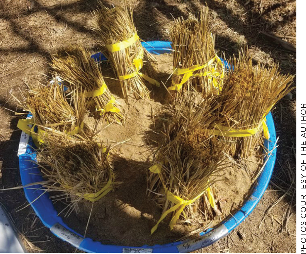
Dune plugs ready for planting
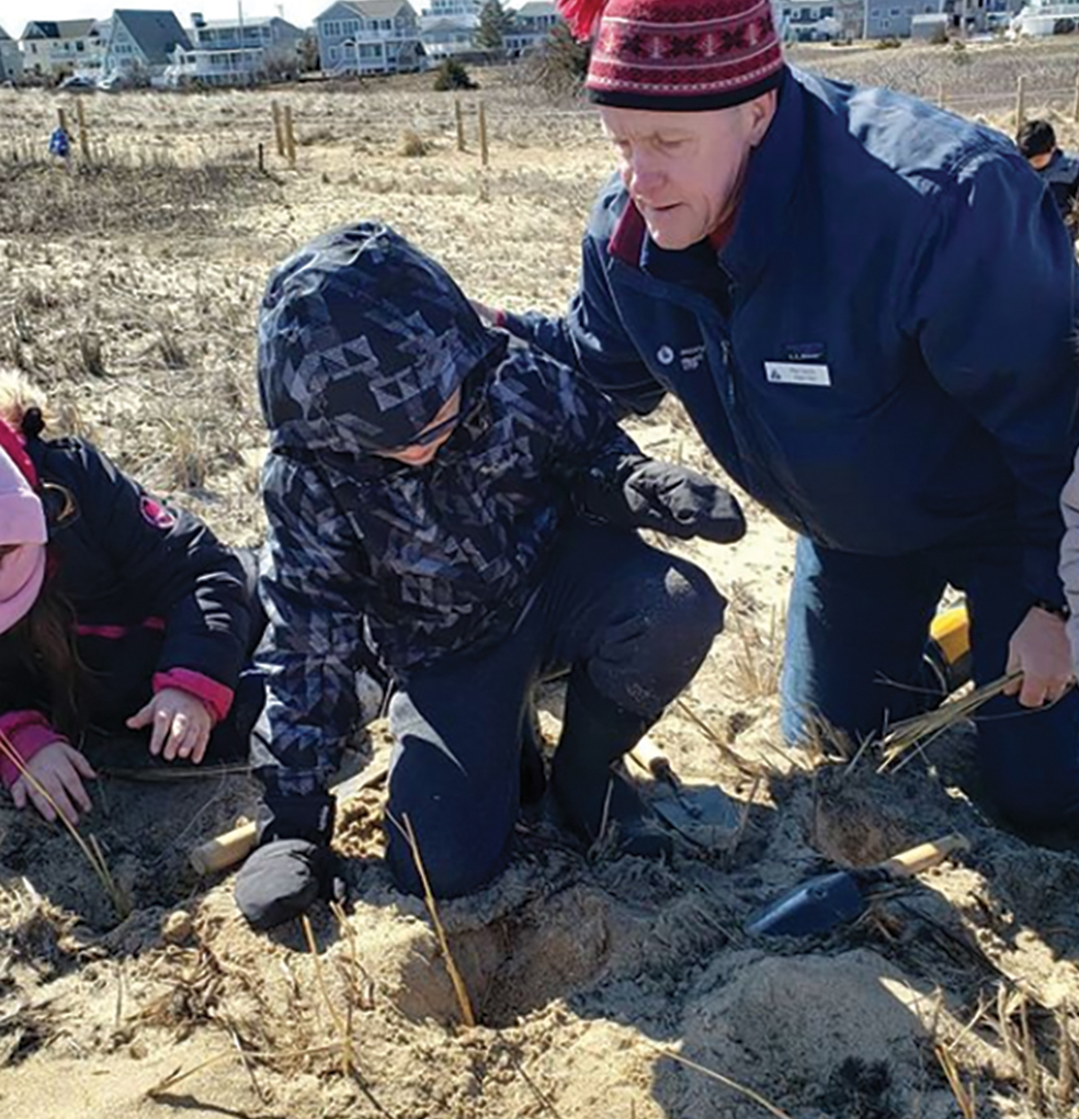
Students plant a dune grass plug with the support of a local volunteer.
Outside, the focus fell on the erosive waves and the dune grass restoration project to be undertaken. Because “successful [field trips] combine elements of structured or guided exploration and learning that are designed with the unique opportunities of the setting in mind” (NRC 2010, p. 168), one group was led beyond the protection of the dunes to the shore, challenged to engineer modifications to a model sand dune using natural materials including sticks, dune grass, and other materials on hand. The land-side of the dune featured the main event! Under the guidance of a local resident volunteer, students carefully walked out to a barren dune location where they were introduced to their dune grass “plugs” and shown how to dig and measure a 4–6 inch hole (CCSS.MATH.CONTENT.2.MD.A.1) before dropping in their seagrass bundles. Across seven days over a two-week span, 320 students traveled to the education center and the beach, planting 1000 seagrass plugs to help slow the erosion of the dune during the next storm season. To ensure students of all physical capabilities could handle the rough terrain, beach wheelchairs were rented when necessary and were able to maneuver the terrain thanks to the physical assistance of aides and volunteers. The plugs cost $400, which was covered by the district’s science consumables budget. When teachers were not taking photographs and videos to share with families and the community back home, they were a part of the process by working with the students to make sense of what they were observing to develop their claims and connect their learning to their previous classroom experiences.
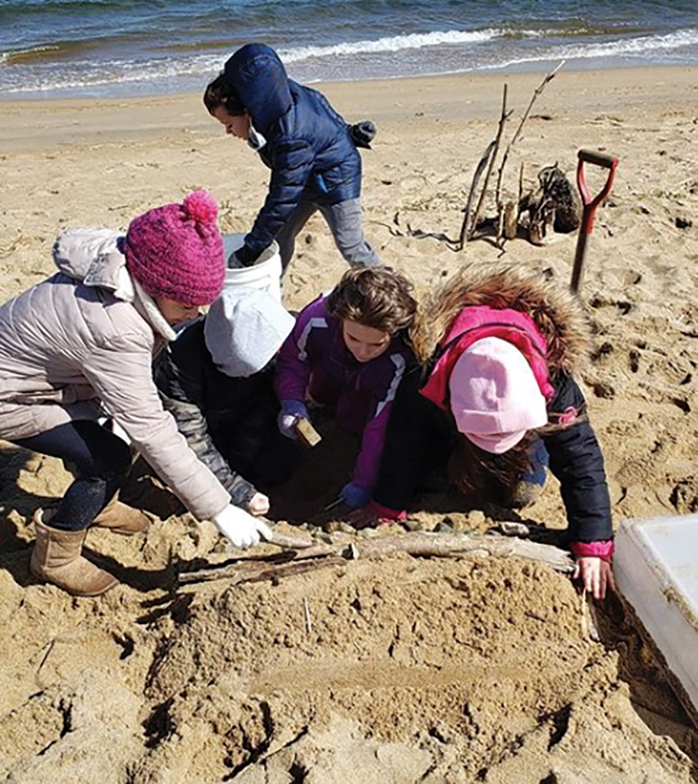
Students continue planting dunegrass plugs.
When well-designed examples of classroom follow-up have been documented, they are in fact associated with positive educational impacts (NRC 2010, p. 170). Following the field trip, all students were asked to reflect and share what they took away from the experience using prompts from the writing program adopted by the district. Some teachers took a significant step beyond reflection by tying the experience to their persuasive writing unit. Students were given the task of taking a side on whether or not coastal homes should continue to be rebuilt in the community, given the additional context provided by the field trip and its first-person experience (CCSS.ELA-LITERACY.W.2.1). Students used modified op-ed articles from the local and regional newspaper to build additional background knowledge of the complicated dynamic between the coastline and its community.
Know Before You Go: Advance Preparation
While the field-trip is arguably an outstanding learning experience for students as a stand-alone event, advanced preparation is needed “to give students a framework for interpreting what they will experience during the field trip” (NRC 2010, p. 167). Timing the conclusion of a newly adopted “Earth’s Changing Surface” curriculum to align with the planting season was essential. Our unit was designed primarily through adaptation of lessons and resources found through the NGSS@NSTA Hub and NSTA Learning Center, focusing first and foremost on leading students to meet the second grade Earth and space science performance expectations 2-ESS1-1 and 2-ESS2-1. Unit lesson plans, resources, and accompanying student scaffolds are available for public review, use, and adaptation in the links that follow this article.
Following the 5E model of instructional design, students were first introduced to the problem of beach erosion through a photograph of an actual home falling into the ocean during a winter storm the previous year. The photograph engages students immediately, driving a class discussion questioning, “What could be causing this house to fall into the ocean?” and prompting students to use visual clues from the photograph to support their claims. With evidence suggesting that both water and wind are present and playing a role, students are excited to investigate when informed they will be seeking evidence to determine whether these natural forces are responsible or not.
Instead of being presented with step-by-step procedures to investigate wind and water’s effect on landforms, students are led through a process by the teacher to develop consensus in the classroom as to how students “might use the eyedropper/straws to investigate how wind and water can change soil or sand?” To support this investigation, model “landforms,” (sand castles constructed of wetted sand or soil, created using one-liter size cups) are presented to students, with students asked to consider what kind of landform the tower might best represent. The teacher models how each student pair will build a sand or soil tower before gathering evidence on how water added using the eyedroppers will affect them. Video demonstrating how to create such towers and modeling this investigation are provided under Internet Resource.
Students develop their model sea barrier during their coastline investigation
Students generate a list of steps as a class to investigate the sand and soil towers before proceeding. To support students meeting Grade 2 measurement and data Common Core math expectations, a variety of measuring tools are made accessible to students and the measure of quantities and distances encouraged around the number of drops, the height at which drops or “wind blowing” is performed, and measurable changes to student sand and soil structures. How students might maintain a clean, safe classroom environment and conduct a recorded, repeatable investigation are presented and explored. Ultimately teachers are required to make sure students use eye protection during the investigations and do not share straws between one another. Students recorded their before and after observations in their science notebooks along with claims supported by their visual evidence as to whether or not the earth models were affected, which force changed the model landforms more, which earth material was affected most by the forces.
Aware that “advance preparation is most effective when it reduces the cognitive, psychological, and geographical novelty of the experience” (NRC 2010, p. 167), students then received an introduction to the location of Plum Island via Google Earth and its “Google Man.” Students were presented with a globe first as a model before being asked to share how the globe was similar or different from the real thing before being introduced to a projection of a Google Maps satellite image of their school and town. Similarities between the globe and the satellite image were shared before students identified what human-made and natural features were visible on Google Maps. Bodies of water in and around the town were specifically identified. The teacher then set their destination for Plum Island and asked to draw comparisons between the bodies of water seen in their town versus those present near Plum Island they were able to make out on the map and surrounding neighborhood. By investigating the landscape through maps and models, toggling between the satellite perspective and Google Man’s ground-level sight lines, the tour confirmed students thinking about what they are seeing in the aerial photos and what the beach, along with its seawalls and jetties, actually looked like. Note: While this lesson could also be used to meet local second-grade social studies standards surrounding geography and its effects on people, it was not explicitly written into the unit at the time of its writing. Additional details outlining this lesson can be found online (see NSTA Connection).
Seeing barriers virtually led to questions from students about which ones were “best at protecting the houses” and the coastline as a whole. This led students to conduct a second investigation, this time using simple materials to model the barriers observed to see if the erosive effects of water could be slowed or prevented. Teachers generated a table with the class identifying the model material, the barrier being modeled, and predictions as to how the barrier might reduce the way the water changed the land. Creating this table allowed students to draw more concrete connections between the model barriers and the actual object they represented, while allowing the teacher to make formative assessments about students’ thinking around the structure, function, and predicted effectiveness of the barriers. Students then tested the materials to determine, “which barriers might be most effective in protecting the houses and the beaches” before documenting their claims and evidence in their notebooks
While not all students came to the same conclusion (given the inevitable variability of execution within a structured investigation with second graders) many students found the sponge-based “dune grass” a particularly effective barrier. Its tendency to stay in place in the sand during their wave-sloshing and keep much (though not all) of their sand from washing away with the waves set the purpose for their planting to come. Future improvements to this lesson could include opportunity for students to select their model sea-barriers from a variety of available classroom materials, explicitly leading students to “Develop simple models based on evidence (their shared properties, structures and function) to represent a proposed object or tool (in this case a sea-barrier.)”
Outcomes
Ultimately, this out-of-the-ordinary field trip provided students with additional first-person perspectives into the effect of the forces of nature on humans and the reciprocal effect of humans on nature. To assess student understanding over the course of the unit, teachers primarily relied on the student thinking documented in their student notebooks and while students constructed explanations shared verbally in class. To support teacher assessment of three-dimensional learning, standards-based grading checklists were provided that teachers use to keep track of which disciplinary core ideas and scientific practices students have mastered or demonstrate progression toward. Teachers who had students use a digital notebook were also able to share student audio recordings articulating science explanations and claims associated with each notebook page through the SeeSaw app purchased through the district.
Perhaps more importantly, the field-trip also presented students with a significant step into the world of civic-engagement, providing students with the opportunity to leave their own imprint on the world while grappling with the foundations of the ever-present tension between human development and our natural environments. Six months on, a recent photograph of the site shows a robust patch of dune grass taking hold, preparing for the coming winter months and its storms along with a sign posted by the educational center, identifying the town’s students as the planters with a message of gratitude. When shared on a district based Instagram account, comments of awe and gratitude poured in, including one left by a parent sharing “my third grader was so excited to see her work!”
Internet Resource
YouTube: Teacher Workshop–Grade 2 Earth’s Changing Surface Virtual PD
https://youtu.be/qdgyqDtka5M
Sean Musselman (musselman@bpsk12.org) is an elementary science specialist and coordinator for the Burlington Public Schools in Burlington, Massachusetts.
Biology Earth & Space Science Elementary Grade 2